
AMERICAN RIVER TREES
ADDITIONAL RESOURCES
This page contains Additional Resource Materials (such as background information, ideas, comments on a particular topic. etc.) which may be helpful when preparing comments on the USACE SEIS/SEIR. They are not intended to be complete comment letters.
Additional resource materials will continue to be added as they become available.
-
DOWNLOAD THIS INFO AS A PDF WITH PHOTOS
Writing Comments on the Draft SEIS/SEIR (Environmental Analysis)
for the American River Contract 3B Project by the U.S. Army Corps of Engineers
Between now and February 23, 2024, the U.S. Army Corps of Engineers (USACE) is accepting comments on the USACE Draft SEIS/SEIR (the environmental analysis report and its appendices) that includes the American River Contract 3B from Howe Ave to Mayhew Drain (as well as other projects). Now is the time to raise your concerns!
The goal is to make specific, well-reasoned comments supported by data or your own observations. The lead agency must respond to these comments, and it can have legal impact if they do not.
These environmental review documents must do several things. They must accurately describe the project, the environmental baseline, the project’s impacts, and whether the impacts are significant. They must analyze alternatives, and to the extent possible they must mitigate these impacts in ways that are specific, enforceable, and achievable.
The lower American River is also protected under state and federal Wild and Scenic Rivers Acts, which means that the Project must protect and enhance the recreational value of the lower American River and the riparian area alongside it.
Letter templates for comments are available here. Fill in your email with informational points provided there – or, if possible, your own additional information! But what information should you provide? Your comment will be most impactful if it is:
Original: Raise important new issues. The more concerns that we bring up, the more they have to respond to.
Credible: Describe your expertise, especially if you have professional knowledge or direct experience, such as if you are a parkway user, neighbor, or school parent.
Factual. Make well-reasoned arguments backed by data. When people state an opinion, an agency can just respond that the “comment is noted.”
Supported by evidence. Provide reports, studies, data, photographs, and references to other plans or standards. When attaching reports, studies, and data, be sure to explain what it relates to and what it proves.
Specific. When people make general comments, they can respond with generalities.
Targeted. State specifically which section of the document you believe is wrong. When it is not clear how a point is relevant to the document, they can ignore it.
Clear. If the average reader can’t understand what a person is trying to say, the staff can ignore it.
Submitted on time. If we do not raise an issue now, before the deadline, we cannot raise it later, and neither could any legal efforts to challenge the project. Submitting anything before the deadline can help to show how many people are concerned.
Take a look at the USACE environmental analysis (both the report and its appendices), and if you think it is incomplete or flawed, use the letter templates to express your concerns! In your letter, you could identify how it:
Incorrectly describes the current conditions
Omits or inaccurately describes impacts that the project will have
Misunderstands whether or not the impacts are significant
Fails to analyze alternatives that would still meet the goals of the project
Did not mitigate the project’s impacts to the extent practicable with specific, enforceable mitigations
Here’s an example –
Original comment:
“The project will stop people from swimming and should be stopped.”
Stronger comment:
“The impact analysis in section {XXX} of the document does not analyze the recreational impacts on swimming. I take my children to swim at the beach directly north of Larchmont Park’s levee staircase approximately twice a week from June through August. About one-third of the time, I see others wading, bringing a raft onshore, or sitting in the shade there. But beachgoers avoid rip-rapped banks of the type that the project would install. [Describe a research study - or instead explain how you know this, such as “I personally avoid the rip-rapped section and do not see others using it.”] The American River Parkway Plan lists recreation as one of five guiding concepts for management of this area. The project should analyze an alternative project design with nature-based solutions that enhance recreational access. The project should also set aside key access points and protect the trees and vegetation that make those areas enjoyable for recreation. [If possible, add an example showing your idea is possible.]”
You might wonder “The document already says there are significant, unavoidable impacts! Isn’t that enough?” The goal of the law isn’t to stop all environmental impacts. The goal is to allow educated public discussion about a project’s consequences and whether there is any way to avoid them, so that decision-makers can make an informed decision. That’s where you come in – you can help make sure that all of the impacts and all of the possible ways to improve it are considered in the decision-making process!
Ready to get started?
Ask yourself: why am I concerned about this project? List a few key reasons.
Open the USACE environmental analysis (both the report and its appendices), then pull up the letter templates.
Review the table of contents to identify the section that best matches your concern. Consider also reviewing the sections for Project Summary, Executive Summary and Table of Impacts and Mitigations.
Ask yourself: did they adequately describe the impacts? If not, identify:
What impacts did they leave out?
What data and observations make you believe that this impact will happen?
Would it be minor or significant? If significant, what makes you think that this would be a significant problem? For example, does it affect many people? Would it contradict existing parkway plans, air quality guidelines, etc.?
Ask yourself: did they mitigate (minimize or offset) the impact as much as possible?
Are there ways to mitigate the impact that were not included? Describe these as specifically as possible.
What makes you believe that your suggestions are feasible? (E.g., have other projects used it as mitigation? Is it an industry standard in another state?)
Are there flaws with their mitigations?
Ask yourself: did they consider a reasonable range of alternatives? (They don’t have to consider every alternative.) Were they discussed in meaningful detail, with enough information for the public to understand, evaluate, and respond?
Note any other flaws you see. Does the document contradict itself (e.g., use one set of data in one place and another somewhere else)? Does it rely on out-of-date data, state conclusions without giving any reasons, or suggest things that don’t make sense?
Remember:
Submit the document to the two email addresses (for USACE and the Department of Water Resources, see below) prior to the close of business on February 23rd, 2024 (PST).
Send it early to be sure no technical difficulties come up!
Anything is better than nothing! Make your letter as strong as you can, but do not worry if you do not have time to address everything. This is a team effort with many of us contributing information. Any unique detail that you add might make a difference!
Submit your official comments to BOTH of these email addresses:
ARCF_SEIS@usace.army.mil
PublicCommentARCF16@water.ca.gov
Reference American River Common Features (ARCF) 2016 Draft Supplemental Environmental Impact Statement/Subsequent Environmental Impact Report (SEIS/SEIR) – December 2023 Report and Appendices, Contracts 3B, and 4A and 4B
Forward your sent email or include a BCC to AmRivTrees@gmail.com.
-
DOWNLOAD THIS INFO AS A PDF WITH PHOTOS
What’s happening?
The Army Corps of Engineers is slated to continue their next phase of large-scale river surgery upstream into the American River Parkway, from Howe Bridge to the Mayhew Drain, over about three river miles. This is part of a larger effort to ensure Greater Sacramento can accommodate more floodwater volume during wet periods, due in part to climate change. The sole focus for the American River is erosion control for the river banks and levees. Overtopping or seepage issues were not identified in need of correction.
The proposed solution is to remove the large majority of trees and virtually all of the ground cover that lines the river bank, to add rocks and soil to the cleared stretches, and to attempt to plant trees again, all over a short period of time. This approach has drawn a considerable amount of public concern.
Why are we alarmed?
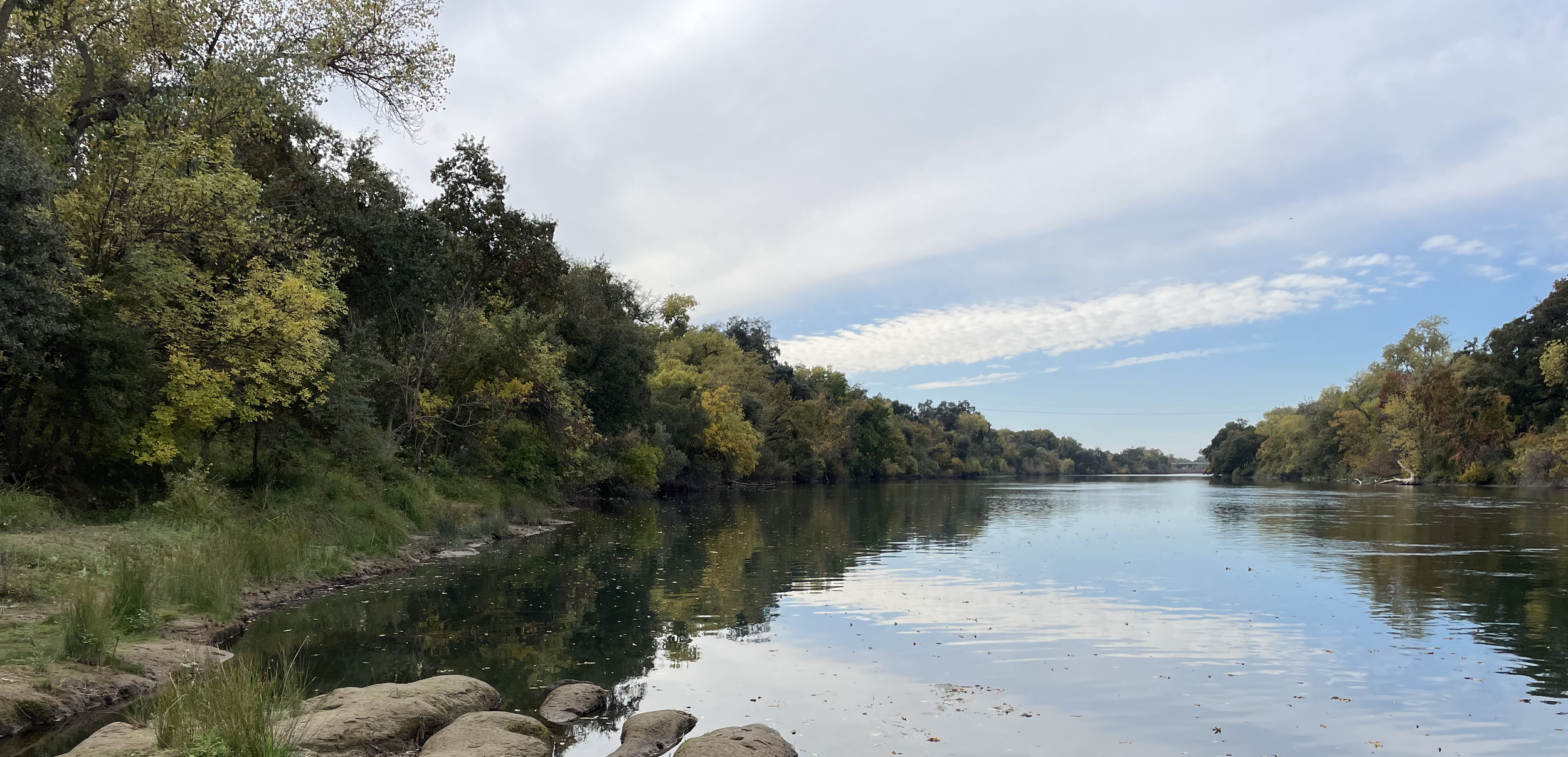
Overall, eleven of the Lower American River Parkway’s twenty six miles are at risk for forest removal, and so far revegetation of bulldozed sections downstream has not gone as planned. The next targeted stretch of channel work contains mature riparian forest with thousands of trees providing square miles of critical habitat and temperature refuge for aquatic and terrestrial species. These ecosystems provide many important services for society, such as maintaining water quality, naturally armoring river banks and increasing resistance to erosive shear stress, and providing recreation and nature space. The area, a lush riparian corridor, is a coveted green space full of trails, beaches, picnic and fishing areas, and river accessways for swimming or small watercraft. The riverbank is critical habitat for endangered Salmonids and other threatened or endangered species. If the project goes forward, most of these resources and activities from multi-mile stretches of river will likely vanish. The Lower American Parkway is one of the few major green spaces in Sacramento and sees more than five million visits a year. Losing major portions of this resource may also cause economic harm. There’s considerable uncertainty whether fundamental components of the construction work are allowable in a Wild and Scenic river, and there are rumors the project’s aggressive schedule is due to impending funding loss deadlines..
Why do we question the proposed solution?
We are skeptical of the evidence provided to justify the need for such a massive intervention. We believe a project of this consequence deserves more investigation, into both diagnosis methods and treatment options. We advocate for using modern analysis methods, maximizing the use of innovative nature-based solutions1 (NbS), and letting the public participate in the project’s strategy and approach.
What causes river bank erosion?
Major factors include how fast the water flows close to the river banks during various ranges of high flows and how susceptible the material near the river bank is to erosion. It is well known that vegetation and trees along river banks - roughness - cause slower water near the river banks. If revegetation does not go as planned, the with-project condition to address erosion will cause faster, more erosive water at the river banks..
How do we predict what might happen?
We have some evidence of the river’s behavior under various flood conditions but the major predictive tool is computer modeling of water flow at levels that haven’t been seen recently. In the last decade this kind of modeling has seen particular growth in applied sciences and engineering. However, the modeling conducted for the construction project dates back to 2004, and is potentially dangerously oversimplified. More modern but still very affordable computational fluid dynamics modelling, and more accurate geologic models, would yield a fresh look at predictions of erosion risk.
Roots vs Rocks?
Many of the oaks along this stretch of the river are older than the US, and have held steady to the bank during flood flows before and after Folsom Dam was constructed. Is it really the best solution to remove nearly all the trees to replace them with riprap? How successful will it be to replant trees in an area where large rocks impede root growth and lack of shade might stunt new saplings? Is the construction style planned generally using modern concepts of river engineering and nature-based strategies, or is it more of an outdated, heavy-handed, one-size-fits-all approach applied to a complex riverine environment? The American River Common Features project dates back to the 1990s.
What’s next?
With State-of-California and federal designation as a Wild and Scenic River, and the only Wild & Scenic river in the United States to pass through a major metropolitan area, the Lower American River truly is the crown jewel of Sacramento, and it’s in need of special attention and a second opinion before undergoing more surgery. We believe the project should be paused and alternative solutions investigated through further study with extensive peer review.
The public comment period for the project has been extended to February 23, 2024.
To write a public comment, go here.
______________________________
1 Solutions that are inspired and supported by nature, which are cost-effective, simultaneously provide environmental, social and economic benefits and help build resilience. Such solutions bring more nature and natural features and processes into cities, landscapes and seascapes, through locally adapted, resource-efficient and systemic interventions. European Commission 2020.
Resource Information and Sample Letters on Specific Topics
-
To Whom it May Concern,
The Army Corps of Engineers claims it is careful about cutting down as few trees as possible in its projects. To quote the American River Erosion Update for March 2023, “We avoid and minimize tree impacts by only removing what is needed to install erosion reduction features.” (American River Erosion Monthly Update March 2023) At least going by their work near Sacramento State University, such assurances appear to constitute a meaningless disclaimer. From Paradise Beach to Fair Oaks Blvd, the Corps clear-cut the trees. If minimizing tree impacts does not preclude clear-cutting the entirety of an enormous project area, then to “avoid and minimize tree impacts” is functionally indistinguishable from “wanton environmental destruction.” Though they acknowledge their work will severely damage some habitats, they trivialize their acknowledgements by claiming that onsite and offsite mitigation will render the damage “less than significant.” It seems that “mitigation” is a get-out-of-jail free card for habitat decimation.
I am especially concerned about the devastation that contract 3b of the American River Watershed Common Features Project proposes for the mile plus long corridor of riparian habitat between the Watt Avenue Bridge and Larchmont Community Park, an area that includes S.A.R.A. Park. (American River Common Features 2016 Draft SEIS-SEIR) Before agricultural reclamation, as well as suburbanization and urbanization, riparian vegetation, to quote Elna Bakker’s An Island Called California, was “often rampant in growth.” (p. 146) But since California became a state in 1850, riparian forest in the Sacramento Valley has declined more than 98%, from 800,000 acres to less than 14,000 acres (Stephen Johnson, Gerald Haslam, and Robert Dawson, The Great Central Valley: California’s Heartland, p. 96). What a rare treasure to have riparian forests such as S.A.R.A. Park, not far away in state parks, but within urban Sacramento County, where people of all walks of life can appreciate “the overwhelming nature of this lowland arboreal landscape and its special character.” (Bakker, p. 147) There is a reason this stretch of riparian lands was the first parcel purchased for the American River Parkway. (https://regionalparks.saccounty.gov/Parks/Pages/WatertonSARAAccess.aspx). It is also named after the Save the American River Association, the local volunteer organization that fights “for the public interest in land and water issues concerning the Lower American River and the Parkway.” (https://www.sarariverwatch.org/american_river_parkway_issues)
Moreover, there are oak trees in this forest that existed before the gold rush, an astonishing feat of survival considering that gold rushers ravaged the state’s forests to supply their flumes and sluices. (Andrew Eisenberg, Mining California, p. 77) What a tragedy it would be to let the Corps sacrifice those venerable elders. I seriously doubt that revegetation is going to produce oak trees as grand as those along this stretch of the river. One study found that in Sequoia forests, “revetments significantly reduced species richness” and the percent cover of vegetation was “significantly higher for no-revetment and revetment removed compared to revetment-intact.” (The Effects of Revetment on Streamside Vegetation in Sequoia Sempervirens (Taxodiaceae) Forests, p. 74) Though the Corps now places planting benches on the riverbanks they rip rap, the study on sequoia forests suggests that trees and other vegetation grow poorly on these kinds of rocky foundations.
I am not trying to diminish the importance of flood control, nor prioritize preservation above safety. As a Ph.D. candidate currently finishing a dissertation about the history of reclamation and flood control in the Sacramento Valley, I understand the importance of continual flood work. Before the creation of the Sacramento River Flood Control Project, storms from atmospheric rivers used to transform the Valley into a hundred-mile-long inland sea. (Robert Kelley, Battling the Inland Sea, p. 5) The SRFCP has made it possible for two million people to live in the Sacramento Region, but the indomitable natural elements of the Valley’s rivers will never stop challenging the engineering which makes populous settlement possible.
Nevertheless, I have also learned that the Army Corps of Engineers is far from infallible, and that unchallenged, their solutions can lead to disaster. Before the California Debris Commission designed the blueprint for the Sacramento River Flood Control Project, another commission of Army Corps officers, led by Major T.G. Dabney, proposed a levees-only flood control solution that would have catastrophically failed if implemented. The Dabney Commission was not a bunch of quacks. They followed the Corps prevailing doctrine, Humphrey’s Thesis. Convinced of the Dabney Commissions’ irreproachable expertise, California created a drainage district with the mandate to implement the Dabney Plan. Fortunately for the taxpayers and for state residents, landowners who were derided by Dabney Plan proponents as scientific illiterates delayed the plan with lawsuits. Had the state carried out the plan, it would have spent millions on levees that the storm waters of 1907 and 1909 would have overtopped or pulverized. (Kelley, p. 267-272). In 1911 the state passed a flood control act which initiated the bypass-based flood control scheme called the Sacramento River Flood Control Project, and after drowning for decades the Valley finally boomed. (Kelley, p. 295-316)
I know that is a long time ago, but the Sacramento River Flood Control Project represents an anomaly in the history of flood control, whereas the principles that animated the Dabney Plan still prevail. The Dabney Plan was premised on the idea of completely controlling rivers. Increase the velocity of flow by confining all the waters between levees, thereby causing the river to dredge its own bottom, making it deeper and capable of accommodating more water during a storm. The current problems with erosion are an unintended consequence caused by the intended consequences of the Corps’ past policies. As the Corps noted in the 2016 Environmental Impact Report for the American River Watershed Common Features Project, the American River has so successfully dredged its own bed (a goal of Humphrey’s Thesis) that its scouring force now turns to its banks. (American River Watershed Common Features General Reevaluation Report, p. 9)
In contrast, the SRFCP was based on recreating the conditions which existed in the Sacramento Valley before the gold rush, on working with the rivers instead of against them. The Valley consists of a series of basins that, before the proliferation of levees, take in the overflow waters of rivers and creeks during storms. The SRFCP mimics this natural condition with a system that uses weirs to direct storm waters into five connected bypasses that drain to Suisun Bay. Land had to be sacrificed to make this project work, as most of the land in these bypasses is private, but the SRFCP has worked for over a century. (Reports on the Control of Floods in the River Systems of the Sacramento Valley and the Adjacent San Joaquin Valley, p. 7-15).
California’s tempestuous growth in the twentieth century, however, seems to have drowned the philosophy behind the Sacramento River Flood Control Project. In the decades following World War II, planners and engineers were so eager to reclaim every inch of land and exploit every drop of water that they assaulted nearly all the nation’s rivers with dams and channelization. (Daniel McCool, River Republic, p. 10-22) Channelization entails clear-cutting levees, straightening rivers, and then armoring riverbanks with rocks or cement. It works by trying to contain all the river’s kinetic energy within the channel. It is, in short, a modern version of Humphreys’ Thesis. This approach directly conflicts with the natural processes of riparian systems, which mitigate erosion with what is called depression storage. Depression storage is created by large tree roots and dense vegetation that absorb and diffuse the kinetic energy of the river, not by trying to resist it. And “Thick, well-developed soils that have well-established vegetative covers tend to be more resistant to erosion” geologist Jeffery Mount wrote in California Rivers and Streams. (p. 105) He also wrote that,
The most important control on the amount of sediment transported by overland flow appears to be the amount and type of vegetative cover and any erosion control efforts that have been implemented. Any land use that reduces the amount and/or density of cover promotes the positivity of overland flow. Vegetation on the slope effectively increases the roughness or frictional resistance to the flow. This acts to reduce the velocity of overland flow and break it up, decreasing its effectiveness. (p. 108)
In other words, the less thick the vegetation on the slope of a river’s natural levee, the faster the runoff and the greater the erosion. It is not a coincidence that erosion and seepage have become such problems after 1980 following two decades where most of the states remaining old growth riparian forests were removed. (p. 198)
The checkered history of channelization also illustrates that rivers inevitably resist “improvement;” thus, Corps “improvements” become costlier and less effective over time. After storms inundated Santa Cruz during the 1950s, the Corps devegetated the San Lorenzo River, straightened it, and lined its channel with concrete and rip rap. They promised that these “improvements” would protect downtown Santa Cruz from a 100-year flood. Instead, the river attempted to restore its profile by filling the channel with 12 million cubic feet of sediment within 10 years of the project’s completion. Santa Cruz subsequently spent millions of dollars to annually dredge a channel which can now only handle 25–30-year floods. (p. 302-304).
Several times in its history, including after the great floods of 1927, the Corps has repented its brute-force philosophy. Following the 1997 floods, the chief of planning for the Army Corps of Engineers in California told the New York Times that while the Corps flood control projects had “never provided for natural flood plains," henceforth the Corps would try to preserve some of the natural functions of rivers. “When we talk about construction now it’s not necessarily concrete,” Walter Yip said. “It’s restoring rivers, putting a meander in, landscaping and revegetation.” (Floods Change Thinking on Need to Tame Rivers)
But the Corps always seems to quickly forget nature’s harsh lessons. In the wake of Hurricane Katrina, the Corps once again mobilized against riparian communities, ordering levee managers to remove all trees within 15 feet of any levee in the nation. They issued this decree even though by the admission of their own dam and levee expert, the agency did not know whether a tree had ever caused a levee failure. Indeed, George Sills, who ran analyses for the Corps to determine the relationship between trees and levee failure in New Orleans, concluded that trees did not lead to any of these failures. He later told the Associated Press that “There’s never been a documented problem with a tree.” (Army Corps Issues Tree Chopping Orders) Nevertheless, the Corps insisted on clear-cutting levees, which would have included removing all trees from 1600 miles of levee in the Central Valley.
Let’s stop to really appreciate the audacity of the Corps’ decision. Migrants from Europe first started settling in river valleys of the North American continent over 400 years ago. To protect their homes and their farms, they have built over 100,000 miles of levees and nearly 100,000 dams. Of the hundreds of thousands of levees and dams they've built over the centuries, there is not a single documented case of a tree causing a levee failure and only one case of trees contributing to a dam failure. Despite overwhelming empirical evidence that trees pose no threat to the integrity of levees, the Corps mandated a breathtaking policy of mass and indiscriminate tree removal.
Fortunately, The Center for Biological Diversity, Friends of the River, and Defenders of Wildlife challenged the Corps in the courts, and at least temporarily, the Corps relented in 2014. Congress subsequently passed the Water Resources Reform and Development Act, which required the Corps to consider—after consultation with federal, state, regional, local, and tribal agencies— “levee safety benefits that can be provided by woody vegetation” and “the benefit of vegetation on levees in providing habitat for species of concern, including endangered, threatened, and candidate species.” (Litigation Reins in Misguided Army Corps Program to Cut Trees from Levees)
To riff off Carl Sagan, extraordinary policies can only be justified with extraordinary evidence. Yet the Corps consistently makes sweeping decisions with vast consequences based on little to no empirical data and usually questionable or unsettled science. They ignore the dynamics of particular environments in favor of universalist, silver-bullet policies. Such was the case a century ago when they insisted that they could apply solutions based on studies of the slow-rising Mississippi on every river in the nation, including the fast-rising Sacramento. It turns out the Humphrey’s Thesis was not even fully applicable to the Mississippi, as the 1927 floods forced the Corps to incorporate spillways and outlets into their designs, methods that decades earlier the Corps dismissed as “chimerical” and “dangerous.” (Ari Kelman, A River and Its City, p. 163-164).
They continued with their silver-bullet approach after World War II when they sought to channelize every stream and competed with the Bureau of Reclamation to dam every major river in the country. As I stated before, the projects that employ blunt instrument approaches become costly to maintain even as they rapidly lose effectiveness. Dams, for example, silt up, diminishing their storage capacity while making them prone to failure. One early twenty-first century study estimated that 85% of dams in the U.S. would reach the end of their operational lives by 2020. According to FEMA, there are 15,000 dams with high hazard potential (i.e. threaten human life) in the United States, and it could cost 50 billion dollars to make these dams safe. (McCool, p. 9-10). Dams also deprive rivers of sediment, leading to a phenomenon known as “hungry water,” which eats away at riverbanks. (Hungry Water: Effects of Dams and Gravel Mining on River Channels)
The current silver-bullet appears to be launchable rock toes and trenches, which the Corps has installed and is proposing to install in several places along the American River Parkway. Launchable rock toes and trenches are just rip rapping by another name. Both entail clear cutting and covering riverbanks with large rocks. The Corps covers the rock toes and trenches with planting benches, which are supposed to restore lost riparian cover. But so much depression storage—as well as arboreal beauty—is lost by replacing thick, multigenerational, well-developed soils and root networks with shallow, single generation soils and plantings.
If the history of levees, damming, and channelization teaches us anything, it is that in a few decades we will learn that this new, covert form of channelization either does not work or incurs unintended consequences. With so few riparian forests remaining, we might not have any left in half a century if no one challenges the Corps. When the Corps proposes a massively destructive policy, we should demand massively compelling evidence. When they raise the specter of catastrophe or balk at the questioning of their purportedly unassailable expertise, we should demand independent verification or analysis. Imagine if conservation groups had not challenged their tree-clearing policy after Katrina?
Our current predicament echoes nineteenth century battles against flooding. No matter how high Sacramento Valley settlers built their levees, the waters always overtopped or blasted through them. Finally, after half a century of futility, planners and engineers asked, how can we work with the rivers instead of against them? How can we restore the natural processes of the Valley in such a way that is compatible with populous human settlement? Out of those questions, the Sacramento River Flood Control Project was born.
We need to ask the same questions today.
Sincerely,
Joshua Thomas
Ph.D. Candidate, History Department
University of California Davis
-
DOWNLOAD THIS INFO AS A PDF WITH PHOTOS
To Whom it May Concern,
I’m writing to comment on USACE’s 2023 SEIS/SEIR for the American River Common Features Project, especially in regards to the inadequate environmental analysis of the plan’s impacts on heritage trees. Chapter 19.04.030 of Sacramento County Code defines a “heritage tree” as a “California oak tree growing on any land in Sacramento County, including privately owned land, with a trunk sixty inches or greater in girth measured four and one-half feet above the ground.” On page 1-7 of the 2023 ARCF SEIS/SEIR, the Sacramento County Tree Ordinance is listed as one of the state and local plans which govern activities within this project area. There is no other mention of the Sacramento County Tree Ordinance in the 2023 SEIS/SEIR, even though USACE’s proposal to remove hundreds of trees in the Contract 3B Area is inconsistent with the goals and purpose of Sacramento County’s tree code. As the Sacramento County Tree Ordinance states in chapter 19.04.010, “in order to promote the health, safety, and enhance the beauty and general welfare of Sacramento County,” it shall be the policy of the County “to provide for the special protection of heritage and landmark trees within the unincorporated area of the County.” Contract 3B South is contained entirely within the unincorporated area of Sacramento County. Considering that some of the heritage trees in this project footprint are over 250 years old, their removal would constitute an essentially “unmitigable” impact on the visual and aesthetic resources of the Parkway.
Given that the Sacramento County Tree Ordinance affords special protection to heritage trees within the unincorporated area of Sacramento County, dozens of which are found in the Contract 3B South area, one would expect the SEIS/SEIR to address potential impacts that pertain specifically within the unincorporated area of Sacramento County. There is no distinction in this SEIS/SEIR made between the impacts on heritage trees in unincorporated Sacramento County and in the city of Sacramento, which does not provide for the same level of protection to heritage trees. The environmental impacts of Contract 3B North, which is located in Sacramento City, and Contract 3B South, which is located in unincorporated Sacramento County, are treated together. This is an inadequate level of environmental analysis that neglects to account for how different areas within the project study protect and regard their environmental resources.
The actual discussion of what proportion of heritage trees will be impacted in this project is also incomplete. In the entire SEIS/SEIR, heritage trees are only mentioned on 9 pages (3-4, 3-5, 3-42, 3-107, 4-144, 3. 1-3, 3.1-23, 3.1-25, 4.1-40) in some of those pages those mentions are only incidental. As for Contract 3B South specifically, where heritage trees enjoy special protection, the heritage oaks are mentioned on two pages. The first mention, on page 3-5, is that one alternative was dismissed as “it would have required removal of heritage oaks.” The second mention is on page 3.1-23, where it states that “a buffer of heritage oaks would be kept in place near both Oak Meadow Park and Larchmont Park, so the viewshed of trees from those parks would be not be affected.” The language of the first mention of heritage oaks for the Contract 3B South area implies USACE has designed the project to avoid removing any heritage oaks. But the language of the second mention implies USACE is only keeping heritage oaks in select areas, such as in front of parks, in order to preserve their “viewshed.” If USACE was not removing heritage oaks in other areas of the project footprint, why would USACE mention keeping a buffer of heritage oaks near Larchmont Park?
In general, the SEIS/SEIR is incredibly vague, inadequate, and incomplete in communicating to the public the impacts they could expect to heritage trees, which constitute an important visual resource in these project areas. The SEIS/SEIR mentions selecting designs to “minimize impacts to heritage oaks” (3-5) or to “reduce impacts to heritage oaks” (3-5) or making refinements that would “Substantially reduce or avoid several of the significant impacts” to “riparian vegetation, and loss of heritage oaks.” (3-107) But does this language of reduction, minimization, and avoidance really convey anything coherent to concerned citizen? Would the end result match anything of their expectations based on the language USACE is using? Let’s use American River Contract 2 to explore the consistency between USACE’s language and what the public might expect. In the SEIS/SEIR for American River Contract 2, USACE stated it would “minimize the removal of existing riparian vegetation” (3-97) and that “impacts to forested wetlands will be minimized to the greatest extent feasible.” (5-7) The following pictures show some of the work USACE did on American River Contract 2. The first was taken from the Guy West Bridge facing the right bank looking left, and the second from the Guy West Bridge facing looking right.
I cannot argue whether or not USACE could have saved at least one tree in these project segments. What I can say is that if somebody told me they were going to minimize forest tree removal, and in the end no trees remained, I would feel like I had been bamboozled. USACE’s language may or may not be technically accurate, but it conveys nothing of the actual impacts. If no trees will remain in a segment, USACE should state that. If only a few trees will remain in a section after construction, USACE should state that. Likewise, if most of the trees will remain, USACE should state that. But “minimizing vegetation loss” tells the public nothing about much forest will actually be lost and how much the visual resources of the Parkway will actually be impacted.
USACE certainly could give the public a more clear indication in the SEIR/SEIS of how many trees they will remove, and what type of trees they will remove. At the December 12, 2023 public presentation for the Lower American River Task Force, USACE told the public that at 65% design 719 trees were going to be removed and at 95% designs that number was 522.
How could USACE provide this information to the public unless they knew either exactly every tree they were going to cut down, or at least mapped out all the areas in the project footprint and estimated the relative density of trees in each segment? USACE could either provide the public with a tree inventory map, or a map which indicates through a color-coded intensity key what minimum proportion of trees could be expected to be removed in each segment. No such map exists in the SEIS/SEIR. USACE does provide a chart showing the total number of riparian forest/scrub removed, but USACE gives no indication of what proportion of heritage oaks they will cut down, where they will cut down these heritage oaks, and the makeup of the 522 trees they are planning to cut down in Contract 3b South. To reiterate, the loss of heritage oaks, some of which are older than this country, is essentially unmitigable.
USACE also provides a low-quality image of the various habitats in the project footprint, but fails to distinguish with any detail the different habitats and much tree loss each segment will suffer.
This practice of providing a very low-detail, zoomed out map of the entire project area notably contrasts with the habitat maps USACE provided for previous SEIS/SEIR’s, such as American River Contract 2, which provided not only section by section habitat maps, but mapped 13 types of habitat, compared to only 4 for the 2023 SEIS/SEIR. Furthermore, the habitat maps for in American River Contract 2 SEIS/SEIR Appendices identified various types of woodland, including oak woodland, which the map for the 2023 SEIS/SEIR does not do. At the very least, USACE is capable of marking out the areas of the Contract 3B segments which have oak trees.
Here is what USACE has for biological resources mapping and data in Appendix D of the 2023 SEIS/SEIR.
USACE’s claim that the loss of forest land is less than significant long-term with mitigation, which allows vegetation to “grow back and provide a natural visual character again,” is unjustified. (3.1-23) If heritage trees are part of the vegetation lost, then the visual character of the area will never be the same. Furthermore, USACE’s claim that project features which will remain even after construction completion, i.e. “the O&M ramps, tie backs, and vegetation free
zone areas,” will constitute an insignificant long-term impact on visual and aesthetic resources because they “are only a small portion of the project site for American River Erosion Contract 3B North and South” (3.1-23) is also inadequate and incomplete. It’s like saying removing 2% of a person’s bodyweight will be insignificant only to find out that the 2% comes from extracting the brain. Likewise, the “portion” of a project site is an inadequate measure of its impact on the visual and recreational resources of the Parkway. If a ramp, for example, goes through a 300 year old oak tree, that is a “substantial degradation to the existing visual character or quality of public views of the site.” USACE needs to show where the access ramps will be and how they will in general avoid impacts to heritage oaks. Otherwise, it is impossible to determine whether or not the long-term impacts to the existing visual character and quality of this project area will be significant and long-term.
A Few of the Irreplaceable Heritage Oak Trees in the Contract 3B South Area
-
To whom it may concern,
I am writing to comment on the inadequate and incomplete environmental analysis of planting bench mitigation in the 2023 Draft SEIS/SEIR for the American River Common Features Project (ARCF). As part of Contract 3B, USACE plans to install several launchable rock toes and buried launchable rock trenches, and in doing so, bulldoze 685 trees. Removing trees to install these features will significantly impact wildlife and fish habitat as well as the recreational values of the American River Parkway. To mitigate these significant impacts, USACE proposes, where feasible, to cover launchable stone with several feet of topsoil, then plant native trees such as cottonwoods, valley oaks, box elders, and alders. However, the flawed design of the planting benches along with the limited period of performance monitoring calls into question whether they are an adequate mitigation measure for the potential long-term, significant impacts caused by Contract 3B’s proposed erosion protection features.
I am principally concerned with what will happen to the riparian vegetation on the planting benches when the launchable stone launches. According to the Geotechnical Report in the appendix of the 2016 General Reevaluation Report, the waterside berm next to a launchable trench is expected to erode, and “will eventually reach the launchable trench.” When this happens, the “soils surrounding the trench will allow for the riprap contained in the trench to ‘launch’ into the void created adjacent to the trench.” (p. 12) If the trench launches as expected, they will likely take down the planting benches with them. This concern was expressed by the National Marine Fisheries Service 2021 Biological Opinion for ARCF. They wrote that a launchable toe rock is “also designed to launch to protect the levee from scour.” “The launching of this type of stone,” NMFS writes, “is likely to result in the loss of some of the mitigation planting bench” and to NMFS “the lack of durability of this mitigation is concerning.” Given that it could not “be accurately determined at what future time this planting bench will be damaged from launchable rock, the overall benefit of the mitigation becomes less certain.” (p. 80)
To address this concern about the durability of planting benches, USACE has agreed to develop a vegetation management plan in coordination with USFWS and NMFS to “Ensure that native riparian plantings installed within the planting benches are protected, managed, monitored, and maintained for 8 years, not to exceed 10 years following installation.” (ARCF Draft 2023 SEIS/SEIR, p. 3-66). According to a technical memo prepared for USACE by HDR David Ford Consulting Engineers, ARCF has a 50-year design. (Lower American River - Subreach 1, 3, and 4 Tier Classification Technical Memo - Nov. 13, 2019, p. 1) Since erosion is cumulative, the likelihood that launchable features launch would only increase each subsequent year after the monitoring period ends, and thus would also increase the likelihood of damage to mitigation planting benches. This increasing likelihood means that without a plan to monitor and protect the planting benches over the entire 50 year life of the project, USACE cannot reasonably claim that planting bench mitigation will make the long-term impact of this project in the area of Contract 3B “less than significant under CEQA.” (ARCF Draft SEIS/SEIR, p. 3.4-12).
USACE has also inadequately addressed how erosion of the planting benches will nullify their effectiveness as long term mitigation. As USACE observed on page 9 of the 2016 General Reevaluation Report Final Environmental Impact Statement/Report, “Both the Sacramento River and the American River are confined by levees and have very little sediment in the water. Additionally, on the American River, Folsom Dam blocks sedimentation from upstream sources. Therefore, the energy of the flow tends to erode riverbanks and levees.” Contract 3b is not widening levees, nor is it increasing the amount of sediment flowing from Folsom Dam. Therefore, the same erosion processes which necessitated ARCF will operate even after the installation of launchable rock toes and trenches as well as planting benches. According to Rood et al (2014) mature riparian trees are highly effective at preventing erosion, even superior to grass, and they recommend that “riparian forests should be conserved to provide bank stability and to maintain an equilibrium of river and floodplain dynamics.” ( Rood, S. B., Bigelow, S. G., Polzin, M. L., Gill, K. M., and Coburn, C. A. (2015). Biological bank protection: trees are more effective than grasses at resisting erosion from major river floods. Ecohydrol., 8: 772–779. Doi: 10.1002/eco.1544.) If the mature trees which armor the banks of the American River in the Contract 3B area are insufficient to prevent erosion, then how can we expect planting benches made up of loose, newly laid soil held in place by immature trees with (for many years) weak roots to not erode away?
USACE’s answer to the problem of planting bench erosion are tiebacks, but even they note that tiebacks only “limit the extent of erosion,” not prevent it altogether. (ARCF Draft 2023 SEIS/SEIR, p. 3-38). Natural banks have deep, layered soils amassed over millennia from fluvial overflow deposit. Even as topsoils erode away, there is still room in the bed materials of natural levees for roots to expand into. In contrast, launchable stone creates an absolute floor. As the planting bench erodes away, the space for roots to grow gets shallower and shallower, until there is nowhere for the roots to go at all. Thus, an adequate mitigation measure based on planting benches would need to provide for the continual replenishment of the planting bench over the entire life-design of the project, 50 years. USACE provides no details in the 2023 SEIS/SEIR as to how deep the planting benches will and how fast they may erode under different flow conditions.
USACE has a history of implementing measures which require long-term commitments. For example, after storms inundated Santa Cruz during the 1950s, the Corps devegetated the San Lorenzo River, straightened it, and lined its channel with concrete and rip rap. They promised that these “improvements” would protect downtown Santa Cruz from a 100-year flood. Instead, the river attempted to restore its profile by filling the channel with 12 million cubic feet of sediment within 10 years of the project’s completion. Santa Cruz subsequently spent millions of dollars to annually dredge a channel which can now only handle 25–30-year floods. (Jeffrey Mount, California Rivers and Streams, p. 302-304). USACE should identify the possibility that planting benches will be a long term commitment for local agencies, particularly county regional parks. The Council of Environmental Quality requires that the lead agency identify “all relevant, reasonable mitigation measures” even “if they are outside the jurisdiction of the lead agency” so as to “serve to alert agencies or officials who can implement these extra measures.” (Council on Environmental Quality, “Forty Most Asked Questions Concerning Ceq’s National Environmental Policy Act Regulations,” https://www.energy.gov/nepa/articles/forty-most-asked-questions-concerning-ceqs-national-environmental-policy-act)
Even with planting bench mitigation, USACE runs afoul of the State and Federal Wild and Scenic Rivers Acts. The Lower American River from the confluence to the Nimbus Dam was added to the National Wild and Scenic Rivers System in 1981 as a recreational river. In Appendix E of the “FInal Environmental Impact Statement for the Proposed Designation of Five California Rivers in the National Wild and Scenic Rivers System,” the US Interior Department and the Heritage Conservation and Recreation Service notes that the protections for values such as “scenic, water quality, free-flowing condition and natural character, geologic, historic, fish and wildlife,” all “link to create an aesthetic environment intrinsic to the overall recreational value of designated rivers.” (p. 9) In other words, the scenic, aesthetic, and natural appearance of the river and its banks cannot be separated from what makes the river “recreational.” Later in the chapter, the Interior Department and the Heritage Conservation and Recreation Service identify the resource values which made the Lower American River a suitable candidate for inclusion in the Wild and Scenic River System. Among these values was “lush riparian growth that includes walnut, oak, cottonwood and sycamore trees.” Part of what makes this “riparian hardwood strip” so valuable for recreation is that “the riparian vegetation is carefully protected,” allowing for the uniform dispersal along the river of “birdlife, including raptors and wading birds.” (p. 26) Thus, any long-term impacts to the riparian forests of the Lower American River would directly affect the INTRINSIC conditions which makes the LAR a State and Federal Wild and Scenic River.
According to the secretarial designation which made the LAR a Wild and Scenic River (Federal Register, Vol. 46, No. 15, January 23, 1981) the LAR would be managed in accordance with the classifications determined appropriate by the Heritage Conservation and Recreation Service. In the Heritage Conservation’s “Evaluation Report on the Eligibility of Five California Rivers for Inclusion in the National Wild and Scenic Rivers System,” they observed that the American River “is lined with lush riparian growth that includes walnut, oak, cottonwood, and sycamore trees.” In classifying the Lower American River as “an outstandingly remarkable recreation waterway,” the Heritage Conservation Service noted that “the American River Parkway is one of the most unique stretches of public parkland in the country because of the close proximity of its natural and recreational features to the urban environment of Sacramento and adjoining communities.” It singled out the “Parkway greenbelt” which provides “many recreation opportunities” that include “hiking” and “canoeing.” They add that the American River and its adjoining riparian lands possess “notable wildlife and botanic values considering its proximity to an urban setting.” Because of the proximity of lush riparian habitat to urban Sacramento, “students of all ages and members of the Audubon Society and the Sierra Club spend a considerable amount of time along the river observing wildlife.” (p. II-32)
In short, the riparian forests of the American River Parkway constitute an essential feature of its outstanding recreational values. If the riparian forests can never come back because of the inevitability of the launchable stone launching, or because erosion diminishes the planting bench over time, then USACE’s chosen mitigation measure of planting benches fails as mitigation. USACE needs to address the erodibility of planting benches, the long-term prospect of launched stone damaging the benches, and how they aim to restore and sustain riparian forests over the 50 year life of this project.
-
VIEW THIS INFO AS A PDF WITH PHOTOS AND GRAPHICS
Please see the PDF for a detailed analysis and findings of a team of professionals regarding hydrology, erosion, geology, and related engineering aspects of the proposed USACE Contracts 3B and 4. (Submitted as a comment to USACE on February 9, 2024).
-
VIEW THIS INFO AS A PDF WITH PHOTOS AND GRAPHICS
To: ARCF_SEIS@usace.army.mil; PublicCommentARCF16@water.ca.gov Cc: Susan E Rosebrough-Jones, National Park Service; Barbara Rice, National Park Service; Harry Williamson;
Liz Bellas, Director, Sacramento County Regional Parks; KC Sorgen, Sacramento County Regional Parks Subject: Put C3B on hold until Folsom Dam Raise Project is complete
Date: February 14, 2024
Put hold on C3B
Dear US Army Corps of Engineers (USACE) and Dept. of Water Resources (DWR) Comment Recipients:
Because we don’t know how well previous contract work will hold up over time or how well the onsite mitigation vegetation will fare and because when the Folsom Dam raise is completed in 2027, a 200 yr flood event will be considered to require only 115,000 cfs discharge rates at the most, which is much lower than the 160,000 cfs flood protection that the current SEIR/SEIS is trying to aim for, let’s pause on further bank erosion projects, until that is finished in three years, and reassess the situation with more public involvement.
With as much riparian habit at stake and so much potential habitat loss and river access loss associated with Contract 3B it makes sense that we would want to know that the type of erosion protection and onsite mitigation being used actually works and does more good than harm! Current observations of the new revetment and planting benches, as well as previous experience at other sites, suggests that the proposed methods may do more harm than good.
The Folsom Dam Raise project is still ongoing but is due to be completed in 2027. Once complete the new water control manual will be adjusted such that in a 200 year flood event, river flows would not exceed 115,000 cfs:
Page 14 of SAFCA Final Urban Level of Flood Protection Plan and Adequate Progress Baseline Report, June 10, 2016
Because of the damage to riparian habitat, the destruction of the Outstandingly Remarkable Value to recreational parkway users protected by the Wild and Scenic Rivers act and because a) we don’t have long-term experience with the effectiveness of the proposed erosion control methods, and instead see signs of failure and b) the project may be overdesigned for 160,000 cfs rather than the 115,000 cfs which the river banks in the area of C3B have already successfully weathered in the past and for which the Folsom Dam Raise Project is designed, let’s please pause on further bank erosion protection measures, such as C3B, and wait at least five years to see how these erosion control measure continue to fare before destroying more natural vegetative armoring that would be best left intact.
If and when we need to reinitiate an erosion control project design phase, let’s do so with full public involvement and with the American River’s Wild and Scenic River status first and foremost in our list of priorities.
Thank you,
William E. Avery, PhD
Professor Emeritus
Local Resident and Professor Emeritus
CSUS
-
To: ARCF_SEIS@usace.army.mil; PublicCommentARCF16@water.ca.gov Subject: Missing figures (3.5.2-11 and 3.5.2-12) impossible to evaluate, suspend 4B
Date: Thursday, February 15, 2024 8:03 AM
Missing figures impossible to evaluate, suspend 4B
The following excerpt from the current SEIS/SEIR, regarding Contract 4B, pages 99 and 100, discuss removal of valley oak trees (Quercus lobata). This will almost certainly involve some heritage oak trees but it is impossible to determine which ones. This section cites proposed footprint Figures 3.5.2-11 and 3.5.2-12 but these figures are nowhere to be found, they were omitted from the document, and so it is impossible to determine the footprint of the project, which trees will be removed, etc. Thus project 4B needs to be removed from the SEIS/SEIR until these figures can be provided for evaluation and public comment.
Excerpt from SEIS/SEIR, pages 99, 100 American River Erosion Contract 4B
“American River Erosion Contract 4B The need for velocity and tree scour work became clear during the risk-informed design process of American River Erosion Contract 3B North and South. As designs were already far along, it was too late to add the additional work to the American River Erosion Contract 3B North and South. Adding this work to the American River Erosion Contract 3B North and South work
would risk delaying American River Erosion Contract 3B North and South, so American River Erosion Contract 4B was created. The flood risk reduction features for the velocity and tree scour work associated with American River Erosion Contract 4B could impact trees in the area. Specifically, a mixture of valley oak (Quercus lobata) and non-native invasive black locust black locust (Robinia pseudoacacia) are within the anticipated construction boundaries. Many of the oaks are heritage oaks and are important to the local community. Currently, there are only conceptual designs in place for this work. Three different activities would be undertaken within the proposed footprint (Figure 3.5.2-11 and Figure 3.5.2-12):
“Trees would be removed to prevent tree scour. The location of each native tree species will be assessed to see if the methods listed below could be used as erosion protection in place of tree removal. It is anticipated that only nonnative trees or trees that cannot be saved using the methods below would be removed.
“About 2 feet of soil-filled revetment would be installed. This also may require about 5 feet of excavation below the surface of the ground for scour protection at the levee toe embankment. Some trees may not survive the excavation and may need to be removed. All this work is proposed to prevent erosion from velocities at 160,000 cfs and 192,000 cfs. Design deviations would be acquired for any trees saved because the trees are within the vegetation free zone of the levee.
“Smaller rocks would be placed above the ground around the trees to armor the trees from scour. Design deviations would be acquired for any trees saved.”
We ask you to please suspend or remove Contract 4B from the several projects covered by the current SEIS/SEIR until the footprint figures (3.5.2-11 and 3.5.2-12) can be provided to the public for review as is required legally by the NEPA and the EIR/SEIR process.
Thank you,
William E. Avery, PhD
Professor Emeritus, Biological Sciences, CSUS
Local Resident
-
VIEW THIS INFO AS A PDF WITH PHOTOS AND GRAPHICS
Date: February 13, 2024 at 1:49:22 PM PST To: ARCF_SEIS@usace.army.mil, PublicCommentARCF16@water.ca.gov Cc: Liz Bellas, Director, Sacramento County Regional Parks; KC Sorgen, Sacramento County Regional Parks Subject: Map, maintain, replace social trails and beaches, small watercraft put-in and take-out points, use only round cobble and gravel for these access points.
To Whom it May Concern:
The American River Parkway is replete with unofficial trails and beach access points. These “social trails” are an essential aspect of the Recreational Outstandingly Remarkable Values (ORV) used to identify the Lower American River as a Wild and Scenic River by state and federal definitions. Not only are they protected under state and federal law but they are beloved by thousands of hikers, birders, and boaters who use them to launch small watercraft such as canoes, kayaks and paddle boards. They offer refuge and safety for wildlife and rest stops for countless tired rafters as well. The planned bank clearing, bulldozing and riprapping the river’s edge with launchable riprap toes will obliterate these trails, destroy access for countless hikers and ruin the possibility of safe access or egress from the river by swimmers or small watercraft.
In USACE Contracts 1 and 2 and 3A no attempt was made to replace the social trails that existed prior to project completion. We want to see something different in the area of Contract 3B. We want to see the social trails and beaches mapped out by Sacramento County Regional Parks and USACE so that they can either be protected during the project or carefully replaced and restored to functionality after the project. We ask that the beaches either be allowed to retain their natural character or be replaced with watercraft friendly and people friendly round cobble and round gravel. Trails should be walkable and retain their natural character or be replaced with some sort of hiker friendly material such as small sized gravel or decomposed granite.
By carefully surveying with GPS, American River Trees has created a Draft working map of the known social trails and river access points that will be impacted by the bank clearing and riprapping proposed by C3B. This map is geo referenced with GPS and can be used with tracking programs such as AvenzaMaps.
We ask that USACE coordinate with Sacramento County Regional Parks to protect, and retain the general character, of all the trails and river access points depicted in the map below:
[See Map]
Thank you,
William E. Avery, PhD
Professor Emeritus. CSUS
-
VIEW THIS INFO AS PDF WITH STRUCTURED TABLE
The Bird Club represents 460 member wo are birders, conservationists, natural resource managers, and researchers from the Central Valley and elsewhere in Californi…
(Because the letter contains very structured table forattng, it is best viewed as the linked PDF.)